If you're a fan of statistics, geography, or both, then check out this collection of fascinating maps that illustrate some eye-opening data. These maps are the ones you never learned about in your high school geography class.
There is plenty of interesting and fascinating information out there about the world we live in. However, it can be difficult to truly understand data by just looking at numbers on paper or in a spreadsheet. When said data is represented in a visual format, it can be much more interesting to look at and easier for one to digest and understand.
If you're a fan of statistics, geography, or both, then check out this collection of fascinating maps that illustrate some eye-opening data. These maps are the ones you never learned about in your high school geography class.
2
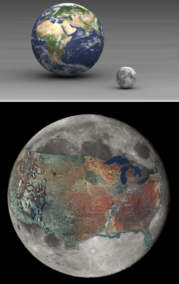
Earth and The United States Compared to the Size of the Moon
3
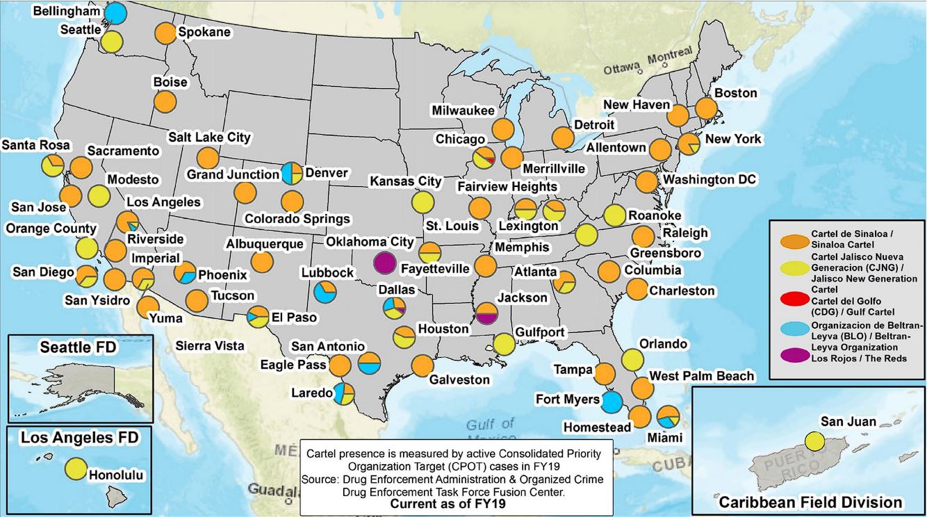
DEA's Map of Cartel Influence in The United States
Major Mexican organized crime groups' areas of influence in the US, according to the DEA's 2020 National Drug Threat Assessment.
4
3D Population Density Map of the US
5
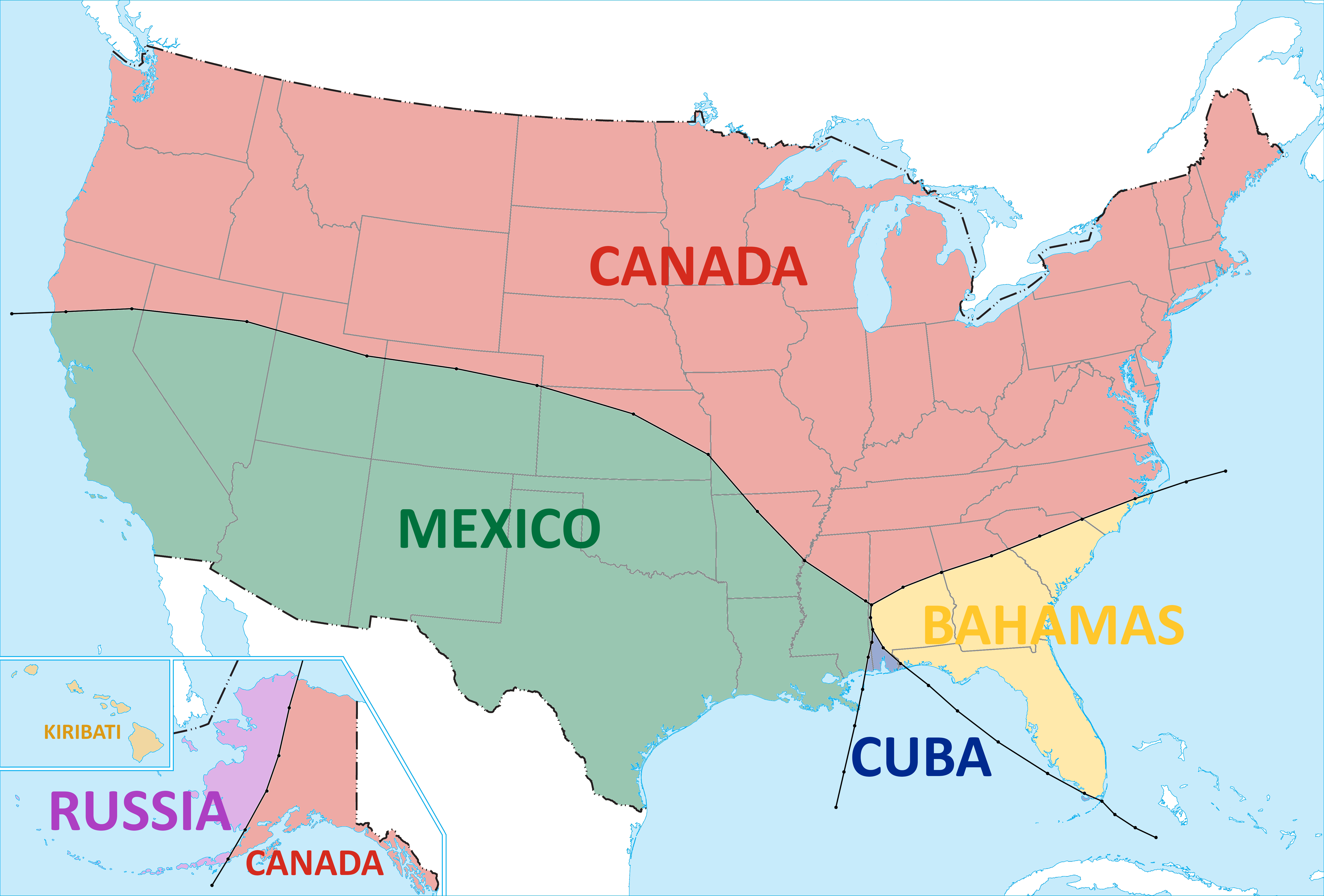
The Closest Country to Each Part of the US
6
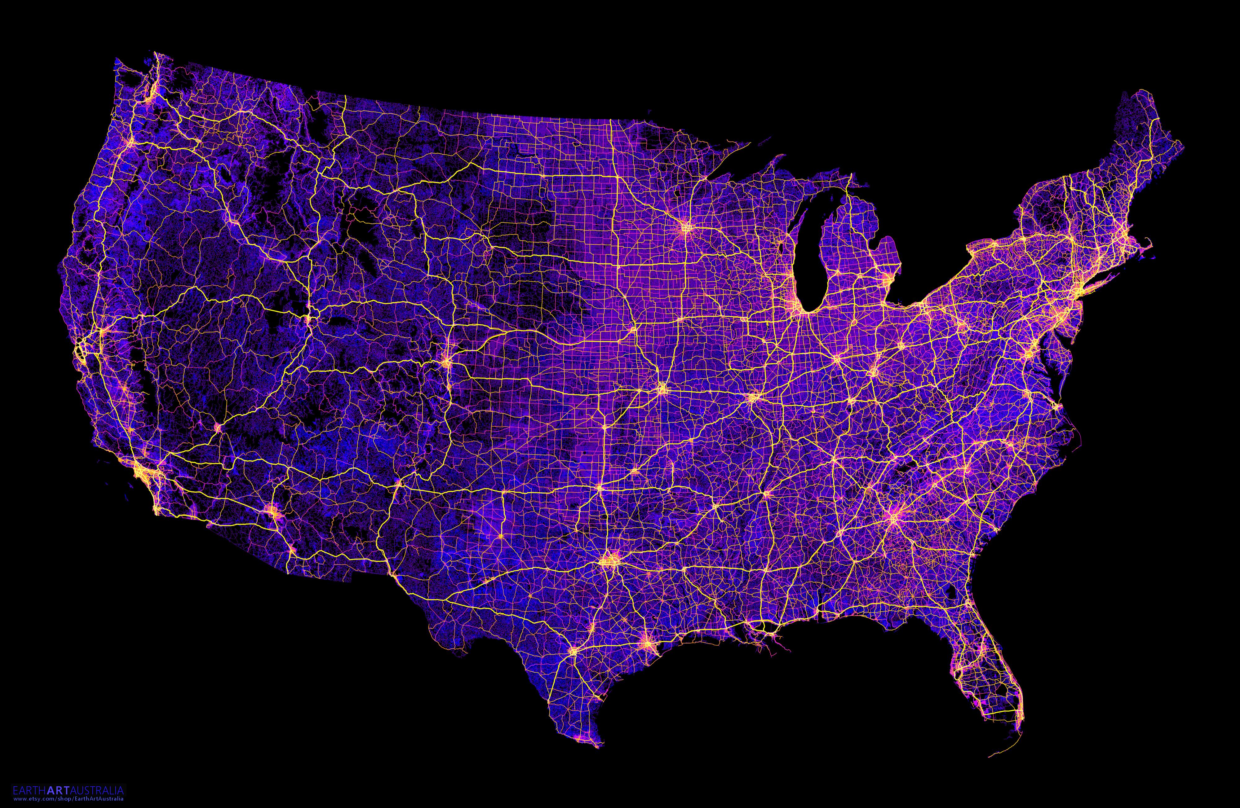
The United States Mapped Only By 8 Million Miles of Roads, Streets and Highways
7
Metric vs Imperial Systems of Measurement
8
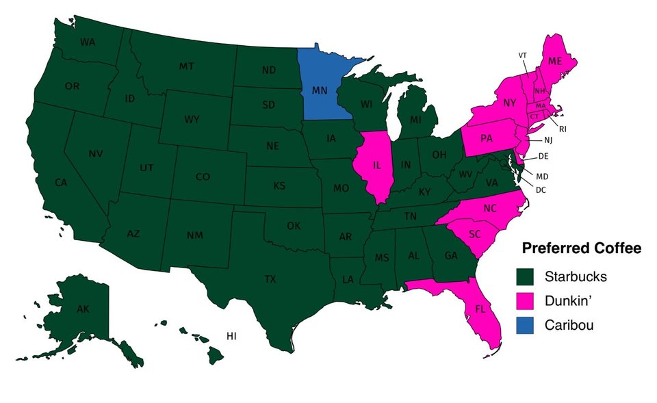
Preferred Coffee Chains Per State
9
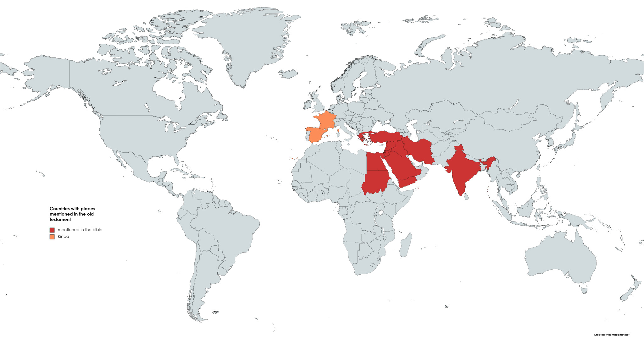
Places Mentioned in the Bible
10
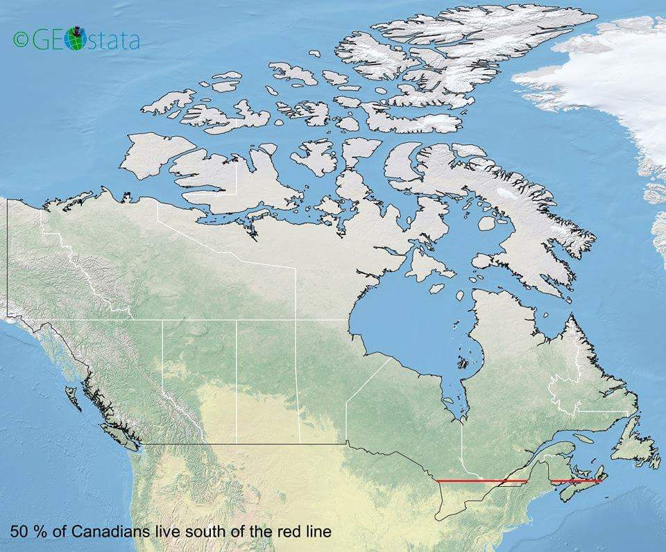
50% of Canadians Live Below the Red Line
11
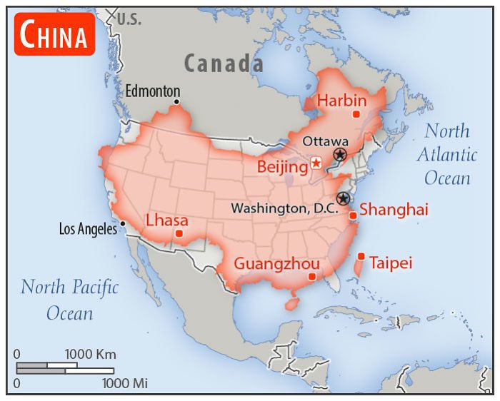
China Compared to the United States
12
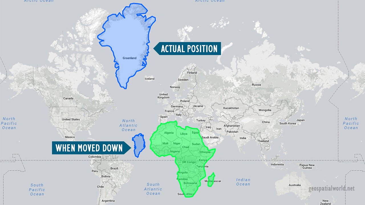
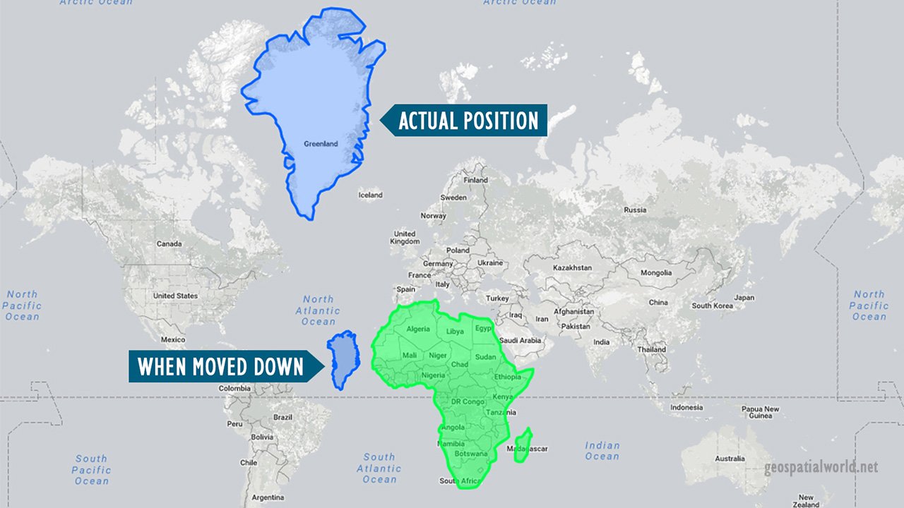
The True Size of Greenland
13
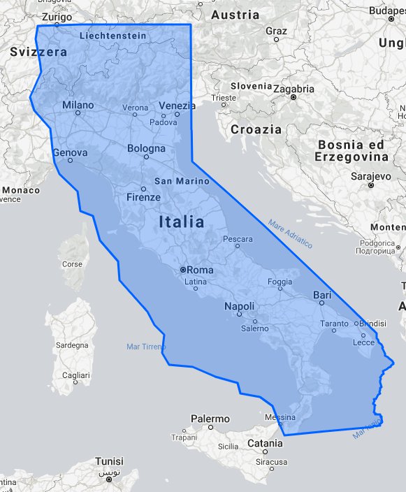
California Compared to Italy
14
Earth and The United States Compared to the Size of the Moon
15
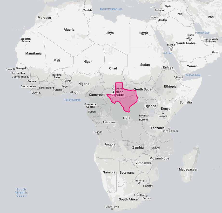
Texas Compared to Africa
16
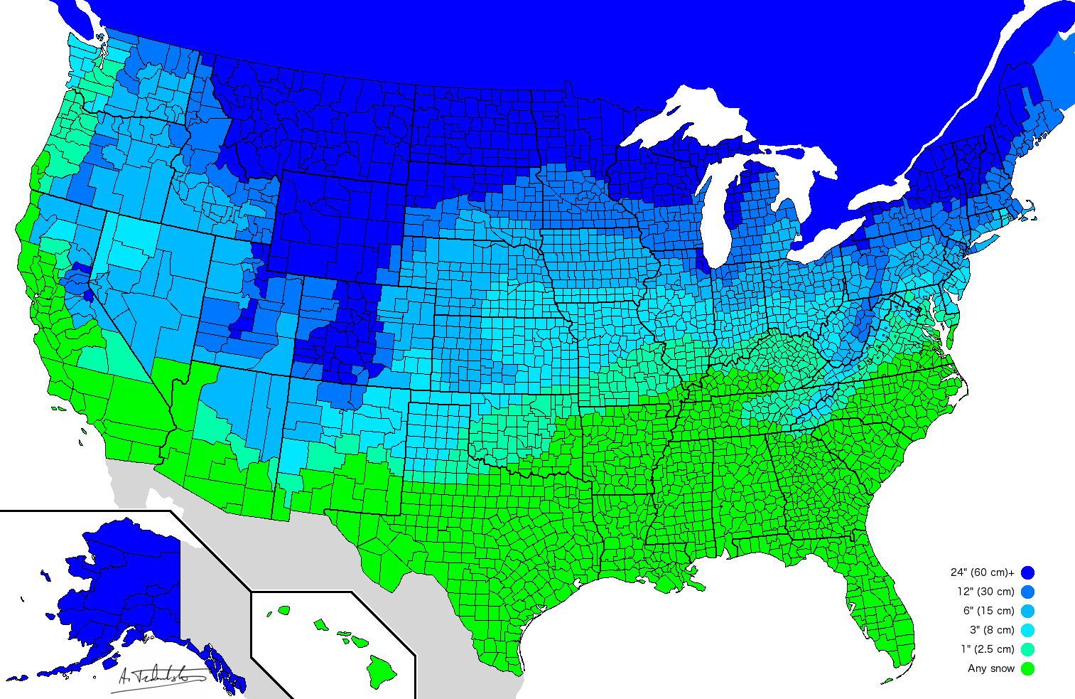
Amount of Snow It Takes to Cancel School in the US
17
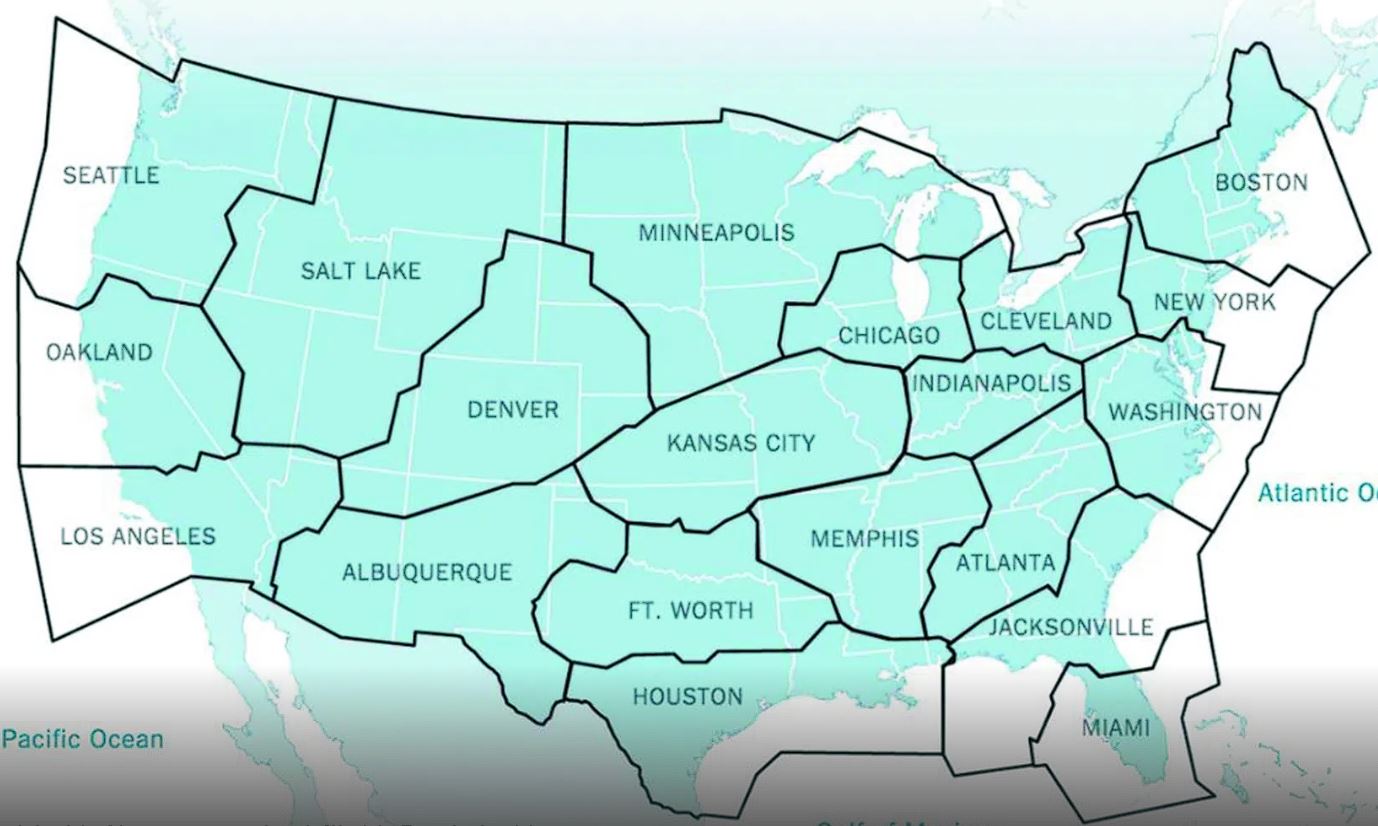
Air Traffic Control Zones
18
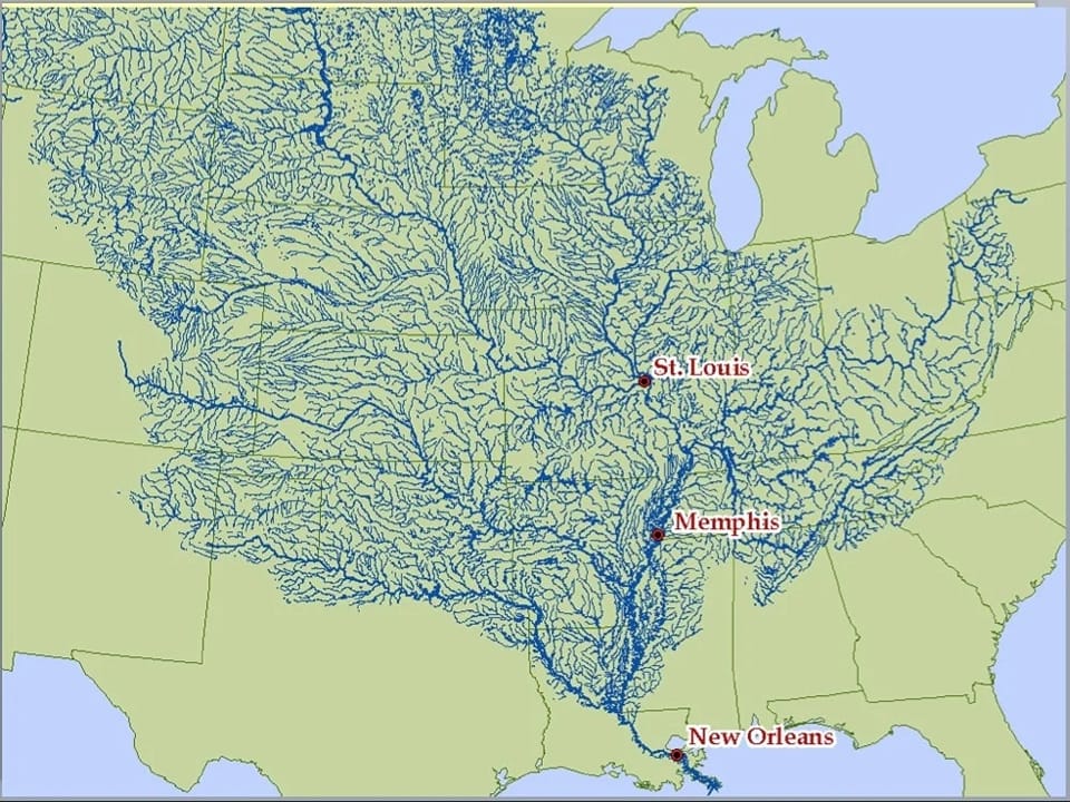
All The Rivers In The US That Flow To The Mississippi
With its numerous streams, the Mississippi’s watershed drains thirty-two states and two Canadian provinces.
19
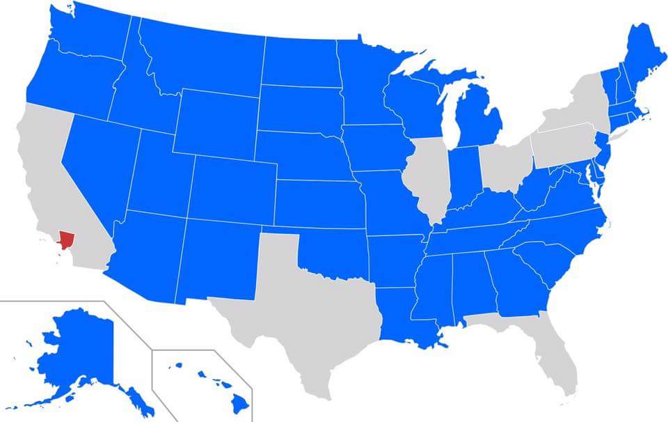
Los Angeles County Population Compared to the Rest of the US
(Los Angeles County in Red) Los Angeles County is the most populous county in the United States, with 9,861,224 residents estimated in 2022. Its population is greater than that of 40 individual U.S. states.
20
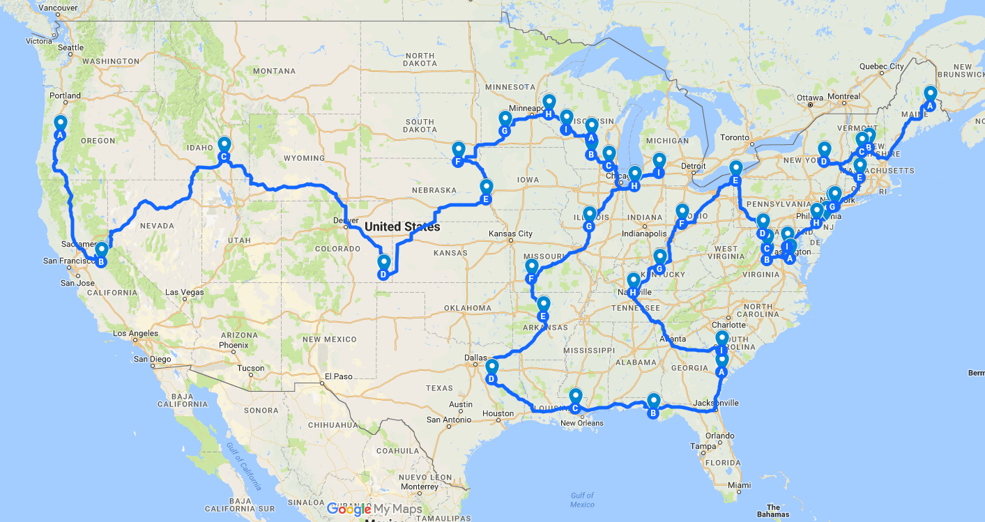
Route to all of the Springfields in the US
21
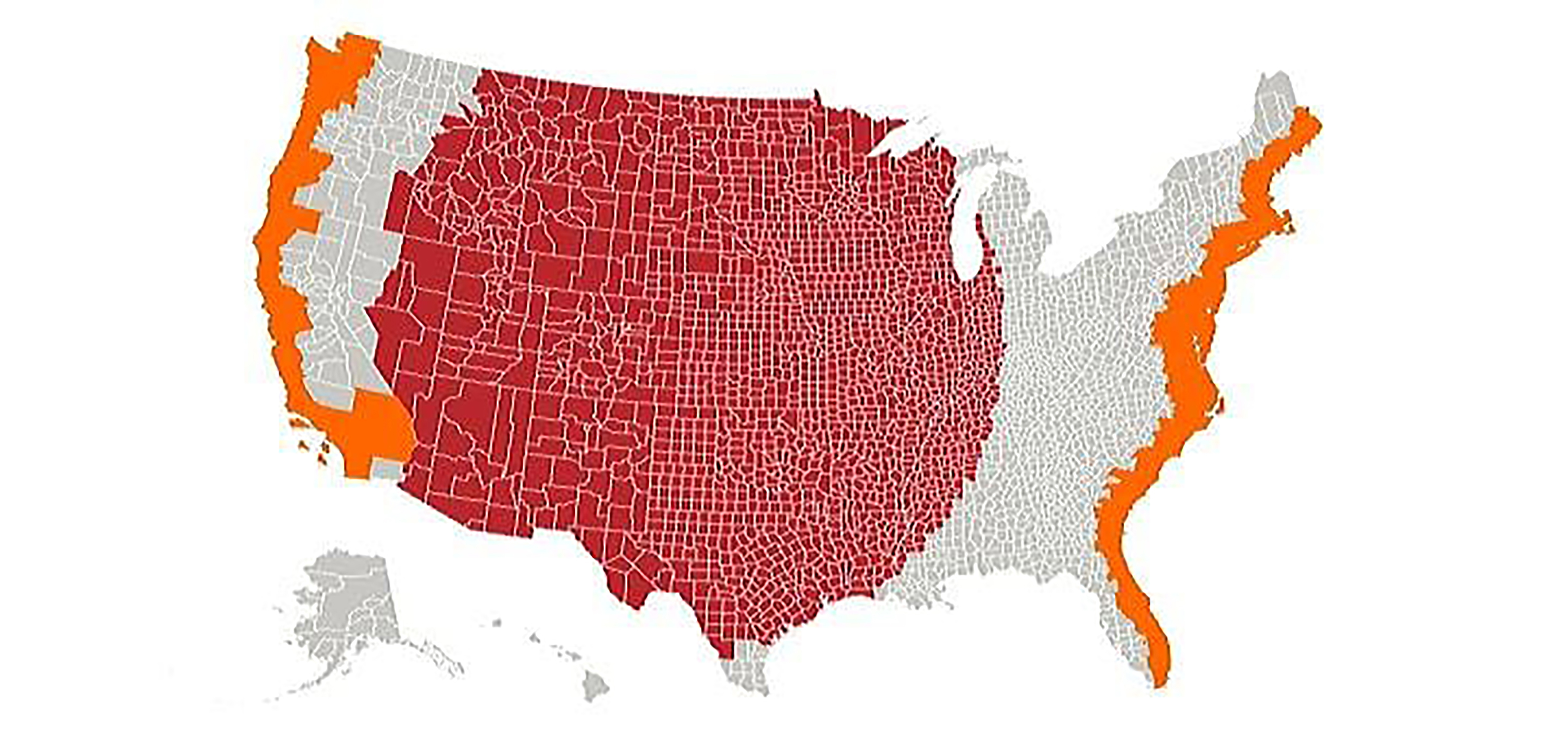
Middle America's Population
The orange sections represent a population equal to the entire red section
22
Places Johnny Cash Has Been in 'I've Been Everywhere'
23
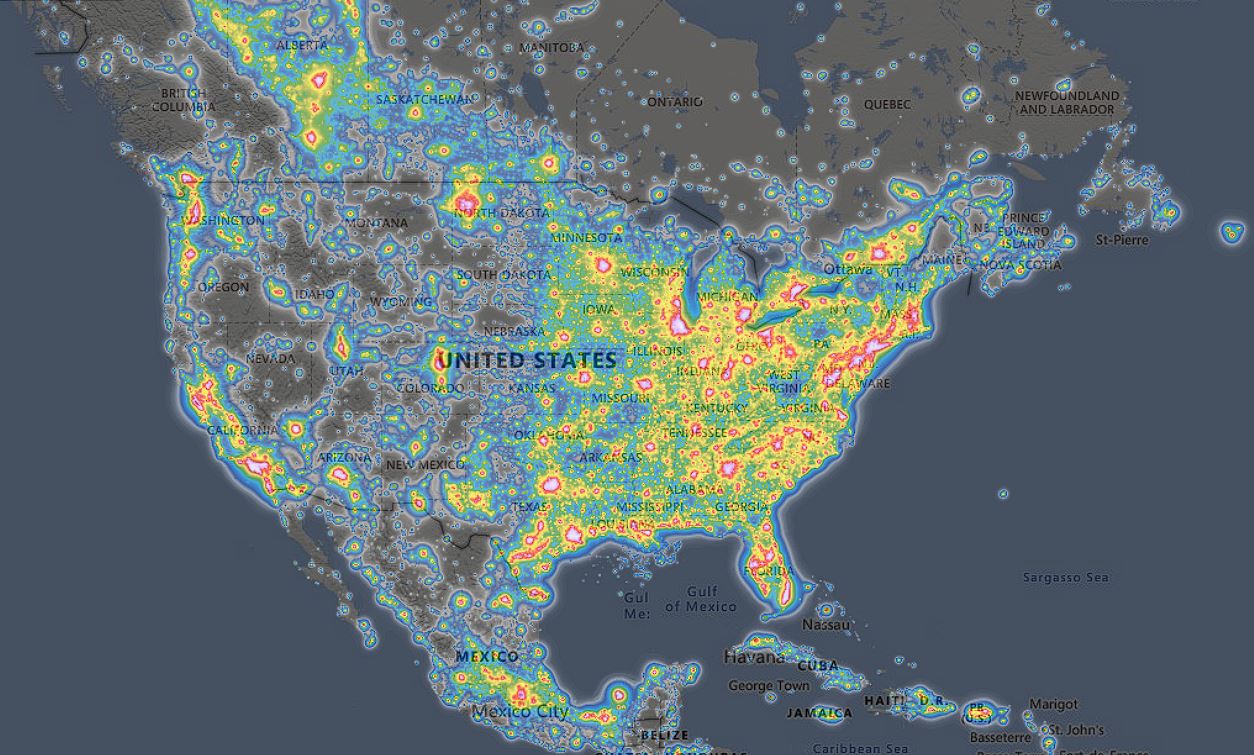
Light Pollution in the United States

